Atlastory: Mapping the history of the world
Atlastory is an open source project to create an interactive map that chronicles the history of life on earth. It’s a “Google Maps” for history.
Certain ideas are “inevitable” over time. Paul Graham calls them “[squares] in the periodic table” — if they don’t exist now, they’ll be created shortly. It’s only a matter of when, not if.
I believe that Atlastory is one of those ideas. The following is a long post about a project I’ve been passionate about for some time now and am currently in the process of winding down.
The Idea
Atlastory is an open source project to create an interactive map that chronicles the history of life on earth. It’s a “Google Maps” for history. The ultimate goal is the ability to see what the world looked like 50, 200, 1000+ years ago. It was inspired by OpenStreetMap & Wikipedia: combining historic maps with cultural and statistical data.
I started Atlastory at first because I’m a fan of both history and good data visualizations. I was surprised something like this didn’t already exist and thought that it would be an amazing educational tool.
Maps are one of the best ways to clearly show an enormous amount of information. Since everything in the past took place at a certain time and location, maps are an obvious choice to visualize that knowledge. Understanding history requires seeing changes and interactions over time, and a four-dimensional map allows this.
“To envision information—and what bright and splendid visions can result—is to work at the intersection of image, word, number, art.” — Edward Tufte
Good design will be a key aspect of the final product. Good information design can communicate a huge amount of knowledge in a small window of time or space. Great information design has a high amount of density and complexity while remaining completely understandable.
The Vision (version ∞)
Atlastory’s purpose is to improve understanding of the past by organizing and visualizing historic knowledge.
My vision for Atlastory was that one day it would become a tool like Wikipedia that’s used regularly around the world. A journalist could use it to go back 20 years to see the geography and timeline of a major world event. A student could use it to go back 20,000 years to see the expansion of human culture across the globe. A climatologist could use it to visualize the historic overlap of population growth with changes in global climate patterns.
Wikipedia organizes information by creating a searchable network of interconnected articles that combine text and other multimedia. Atlastory can be the first medium that allows completely visual navigation, displaying information at a much higher density and level of interactivity.
Imagine students in a classroom learning about World War II. You'd be able to see the country borders of Europe as they existed in 1942. Drag the timeline, and see the borders change as the years go on. Turn on an overlay of population density or GDP per capita and see the flow of activity throughout the war. Zoom in and see the troop movements of a pivotal battle.
The visual interactivity would make it much more enticing for people, young and old. Almost game-like in terms of exploration and discovery.
Eventually, the timeline could go back far enough that you're able to see continental drift and other pre-historic geographic or environmental changes.
Map content
Maps can be broken down into a few different types:
Physical — shows the physical landscape including mountains, rivers, lakes.
Political — sovereign, national and state boundaries, with cities of all sizes. The typical world map you see will be political with some physical features.
Road — shows roads of various sizes along with destinations and points of interest. Google Maps & other navigation apps fall into this category.
Statistical — shows statistics about human populations such as economic stats, population density, etc.
Scientific — thematic maps that can show climate, ecological regions, etc. (see the climate map below)
Events — shows how a specific event played out geographically, like WWII or Alexander the Great's conquests.
Any map type that has enough data to span long periods could eventually go into the Atlastory system. Event, thematic, statistical, and scientific maps could all seamlessly layer on top of the main "base map".
Base map
The Atlastory base map should be an elegant combination between 3 map types: physical (basic landscape features), political (sovereign and administrative boundaries), and cultural (see below). Major roads and infrastructure would be added only after a worldwide "structure" of the base map was created.
Importantly, map creation should be top down, from global to local. The purpose of an Atlastory map is not navigation, it is understanding of history. Creating a global structure will also provide context and make it easier to interest other users/contributors.
Cultural cartography
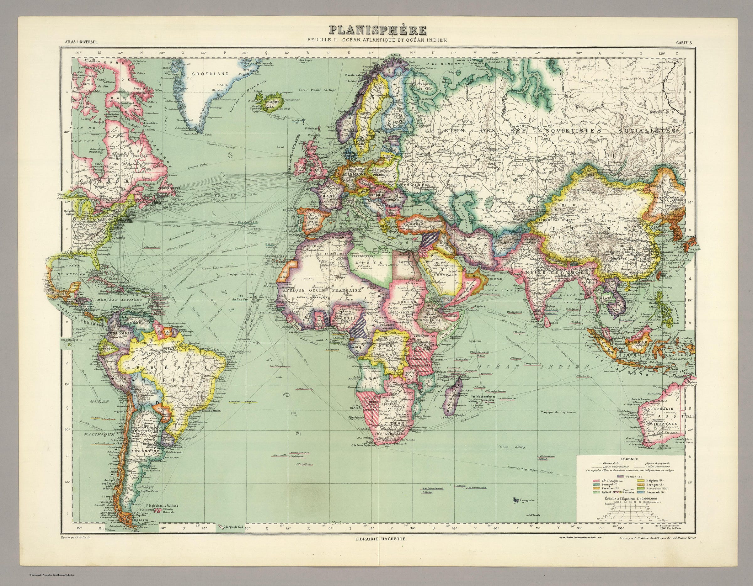
Most world maps made today (of the present time or of the last few hundred years or so) are of the political variety. But what happens when you go back a few thousand years? What about areas of the world where, even now, aren't necessarily defined by geopolitical boundaries?
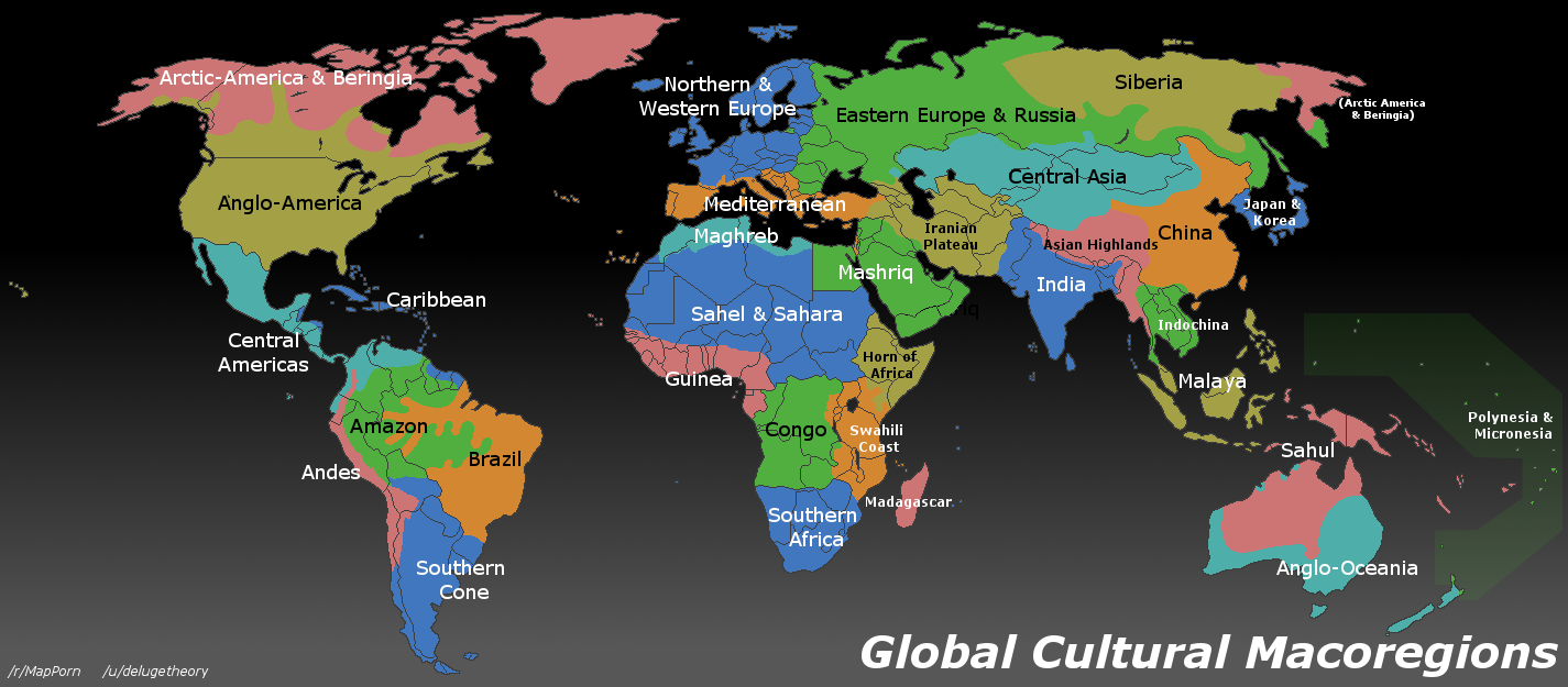
The solution is mapping cultural regions. Culture, in this case, being human societies with common language, belief systems, and norms. “A cultural boundary (also cultural border) in ethnology is a geographical boundary between two identifiable ethnic or ethno-linguistic cultures.”
A cultural map would have different levels, just like political maps: from dominant cultural macroregions to local divisions between subcultures or classes within a society (blue collar vs. white collar, etc.).
Combining cultural cartography with typical map types allows for a much better understanding of both modern and ancient history. Culture plays a major role in world events & limiting the map to only defined borders paints an inaccurate view of history.
(Notice any overlap between cultural regions and the climate regions in the map above it?)
The Tech
The technical infrastructure behind Atlastory has a few basic components:
A database of nodes (latitude/longitude points) organized into shapes, layers, types, and time periods.
An API that manages, imports and exports data from the database.
A crowdsourced map editor interface (like iD for OpenStreetMap, but designed specifically for top-down time-based editing).
A map rendering service that turns raw map data from the database into vector tiles that can be styled for viewing.
The map itself: a web interface to view and navigate the maps.
Most of the components would be built from existing open-source tools created by organizations like OpenStreetMap, MapBox, and CartoDB. There has been a lot of technical innovation in this field over the past few years which is one of the main reasons something like Atlastory is now possible to build. (Although given what I known about the requirements still very challenging.)
Read more about the technical requirements...
The current status and future of Atlastory
I’ve been working on this as a side project for more than 3 years now. Originally I imagined being able to quickly find a way to profit from the service. But as development dragged on and other commitments began taking up more of my time, I realized I’d never be able to finish it alone.
Earlier this year I joined Mashgin, a startup in the Bay Area, as a full-time “Generalist.” My spare time completely dried up and I decided everything needed to be completely open sourced and distributed to anyone interested in the project.
Due to personal time constraints, I can’t continue with it so I’m looking for others who are interested. This could mean taking over / adapting the codebase or using other means to pursue the idea. See below for more details on what’s currently done. Although many of the back-end components are functional, the infrastructure is in a rather unusable state right now.
Please contact me or leave a comment below if this strikes your curiosity or you know anyone else who would be interested. I’m happy to answer any questions.
Resources
Atlastory Ideology (Github) — In depth re: roadmap to final vision
Atlastory API Code (Github) — API code (currently up at api.atlastory.com) for storing/retrieving data
Atlastory Base Map (Github) — the actual base map with currently uploaded data as GeoJSONs
List of resources for historic map content (Google Doc)


